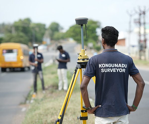
Digital Survey
With over two decades of experience, Kongunadu Associates is a leading provider of digital surveying services, having worked in diverse terrains, including urban, rural, and remote areas. As Coimbatore’s premier surveyor, we have built a strong reputation for delivering accurate and timely survey services for esteemed builders, contractors, and construction companies across Coimbatore, Chennai, Tamil Nadu, and India. Our services include land surveys, topographical surveys, sub-division surveys, boundary surveys, contour surveys, plot demarcation, and building demarcation.
Our experienced team prioritizes quality work, precision, and on-time delivery, using cutting-edge technology to ensure superior survey results. We take pride in having successfully completed several government projects and surveys for renowned companies, which has earned us the trust and confidence to meet all your survey requirements to the highest standards.
Kongunadu Associates maintains long-term associations with leading engineering firms and mapping organizations across Tamil Nadu. Our expertise has supported various government projects, including planning and designing roadways, drainage systems, earthworks, water supply networks, and transportation projects in Coimbatore. We incorporate the best practices and the latest technology for surveying purposes to guarantee the highest levels of accuracy.
Innovative Digital Surveying
We bring a new perspective to land surveying by using advanced aerial technologies. Our digital land surveyors take to the skies, capturing 3D figures and geographical data to assist agriculturists, builders, miners, real estate developers, property valuers, and more. With airborne surveying, we provide accurate and detailed data for large land areas without interruption.
Our cutting-edge digital survey technology, combined with extensive industry experience, allows us to provide precise, real-time 3D models and virtual tours of your property. Using LIDAR RGB mount drones, we create topographical maps that show the true elevation of surfaces, with contours and digital terrain models for comprehensive analysis.
Why You Need a Surveyor
Proper surveying is crucial to avoid legal issues and ensure that construction is within the legal boundaries of your property. Mislocated structures can lead to costly legal disputes and construction losses. By consulting a licensed land surveyor, you can accurately define your boundaries and ensure compliance with setback requirements and government regulations.
Investing your hard-earned money and time into a construction project requires precision. Hiring a professional surveyor to demarcate the boundaries of your land will protect your investment and ensure that you meet all legal and regulatory standards.
